Nisf Jubeil
| Nisf Jubeil | |
|---|---|
| Other transcription(s) | |
| • Arabic | لﻴﺒﺠ ﻑﺼِﻨ |
| • Also spelled |
Nisf Jbeil (official) Nisf Jubayl (unofficial) |
|
Nifs Jubeil, 1936 | |
  Nisf Jubeil Location of Nisf Jubeil within the Palestinian territories | |
| Coordinates: 32°16′58″N 35°13′14″E / 32.28278°N 35.22056°ECoordinates: 32°16′58″N 35°13′14″E / 32.28278°N 35.22056°E | |
| Palestine grid | 170/187 |
| Governorate | Nablus |
| Government | |
| • Type | Local Development Committee |
| • Head of Municipality | Adil Barakat[1] |
| Population (2007) | |
| • Jurisdiction | 394 |
| Name meaning | "The Watershed"[2] |

Nisf Jubeil (Arabic: لﻴﺒﺠ ﻑﺼِﻨ also spelled Nisf Jbeil or Nisf Jubayl) is a Palestinian village in the Nablus Governorate in the northern West Bank, located northwest of Nablus. According to the Palestinian Central Bureau of Statistics (PCBS) census, it had a population of 394 in 2007. There were a total of 83 households and 17 business establishments.[3]
Geography
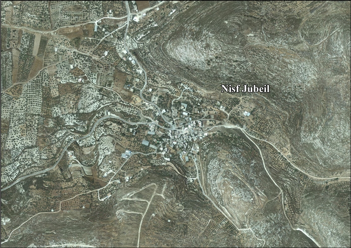
Nisf Jubeil is situated on a terrace along the Wadi Nib outlet of the Sebastiya Valley, with an approximate elevation of 400 meters above sea level. It is 2.5 kilometers east of the town of Sebastia.[4] Other nearby localities include Ijnisinya to the south, Yasid to the east and Beit Imrin to the north.[5] The nearby Ein Sharqiya spring serves as a source of water and there are 30 cisterns in the village.[4]
History
Ottoman era
In 1596, Nisf Jubeil appeared in Ottoman tax registers as "Jubayl", a village in the nahiya of Jabal Sami in the liwa of Nablus. It had a population of 30 Muslim households and 36 Christian households, and paid taxes on wheat, barley, summer crops, olive trees, goats and beehives.[6]
In 1838 there were approximately 200 Christians, including a priest living in the village.[7] Victor Guérin found an ancient sarcophage in Nisf Jubeil, used as a trough. He estimated there were 300 inhabitants, including some Christians.[8] In 1882, Nisf Jubeil was described as "a small village in an open valley, with a spring to the east and olives. Some of the inhabitants are Greek Christians."[9]
British Mandate period
In the 1922 census of Palestine conducted by the British Mandate of Palestine, its population was 162 (including 88 Christians),[7][10] increasing to 210 (including 105 Christians) in the 1931 census.[1][11]
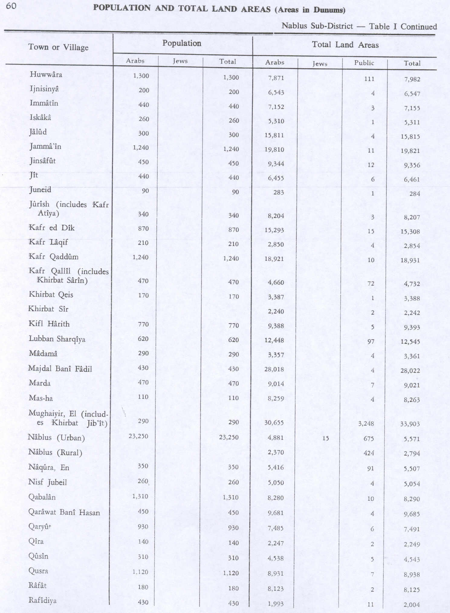
In 1945 the population was 260; 80 Muslims and 180 Christians,[12] while the total land area was recorded as 5,054 dunams.[13]
1948-1967
In the wake of the 1948 Arab–Israeli War, and after the 1949 Armistice Agreements, Nisf Jubeil came under Jordanian rule.
1967-present
After the Six-Day War in 1967, Nisf Jubeil has been under Israeli occupation. In 1979 Nisf Jubeil's built-up area amounted to 25 dunams. Its village center contained a few old houses, two Greek Orthodox churches and a mosque,[4] called the Nisf Jubeil Mosque.[14] The mayor of the village is currently Adil Barakat.[1] Nisf Jubeil has a mixed population of Christians and Muslims.[15]
References
- 1 2 3 Nisf Jubeil Profile. Jerusalem Media and Communication Center.
- ↑ Palmer, 1881, p. 189
- ↑ 2007 PCBS Census. Palestinian Central Bureau of Statistics. p. 108
- 1 2 3 Zertal, 2004, p. 451
- ↑ Map of Nisf Jubayl. Google Maps. Map depicts various localities surrounding Nisf Jubeil.
- ↑ Hütteroth and Abdulfattah, 1977, p. 129
- 1 2 Ellenblum, 2003, p. 249
- ↑ Guerin, 1875, p. 210
- ↑ Conder and Kitchener, 1882, SWP II, p. 160
- ↑ Barron, 1923, Table IX, Sub-district of Nablus, p. 24
- ↑ Mills, 1932, p. 63
- ↑ Department of Statistics, 1945, p. 19
- ↑ Government of Palestine, Department of Statistics. Village Statistics, April, 1945. Quoted in Hadawi, 1970, p. 60
- ↑ Supplementary List of Moslem Holy Places in Palestine outside the area of Jerusalem. United Nations Conciliation Commission for Palestine. 1949-11-28.
- ↑ Saadeh, Youssef Jubran. Christianity in Nablus. Zajel. 2004-06-27.

Bibliography
 |
Wikimedia Commons has media related to Nisf Jubeil. |
- Barron, J. B., ed. (1923). Palestine: Report and General Abstracts of the Census of 1922. Government of Palestine.
- Conder, Claude Reignier; Kitchener, H. H. (1882). The Survey of Western Palestine: Memoirs of the Topography, Orography, Hydrography, and Archaeology. 2. London: Committee of the Palestine Exploration Fund.
- Department of Statistics (1945). Village Statistics, April, 1945. Government of Palestine.
- Ellenblum, Ronnie (2003). Frankish Rural Settlement in the Latin Kingdom of Jerusalem. Cambridge University Press. ISBN 9780521521871.
- Guérin, Victor (1875). Description Géographique Historique et Archéologique de la Palestine (in French). 2: Samarie, pt. 2. Paris: L'Imprimerie Nationale.
- Hadawi, Sami (1970). Village Statistics of 1945: A Classification of Land and Area ownership in Palestine. Palestine Liberation Organization Research Center.
- Hütteroth, Wolf-Dieter; Abdulfattah, Kamal (1977). Historical Geography of Palestine, Transjordan and Southern Syria in the Late 16th Century. Erlanger Geographische Arbeiten, Sonderband 5. Erlangen, Germany: Vorstand der Fränkischen Geographischen Gesellschaft. ISBN 3-920405-41-2.
- Mills, E., ed. (1932). Census of Palestine 1931. Population of Villages, Towns and Administrative Areas (PDF). Jerusalem: Government of Palestine.
- Palmer, E. H. (1881). The Survey of Western Palestine: Arabic and English Name Lists Collected During the Survey by Lieutenants Conder and Kitchener, R. E. Transliterated and Explained by E.H. Palmer. Committee of the Palestine Exploration Fund.
- Robinson, Edward; Smith, Eli (1841). Biblical Researches in Palestine, Mount Sinai and Arabia Petraea: A Journal of Travels in the year 1838. 3. Boston: Crocker & Brewster. (Robinson and Smith, 1841, vol 3, p. 144)
- Zertal, Adam (2004). The Manasseh Hill Country Survey. 1. Boston: BRILL. ISBN 9004137564.
External links
- Welcome To Nisf Jubeil
- Survey of Western Palestine, Map 11: IAA, Wikimedia commons
- Nifs Jubeil, aerial photo

| Cities |
|   |
|---|---|---|
| Municipalities | ||
| Villages |
| |
| Refugee camps | ||